


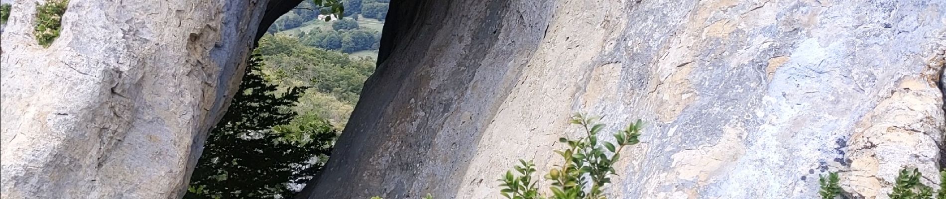
les arches de Combleroufle

bymarc26
User

Length
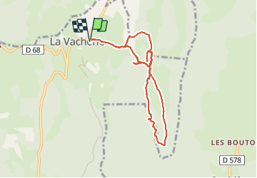
9.6 km

Max alt
1222 m

Uphill gradient
502 m
Km-Effort
16.3 km

Min alt
938 m

Downhill gradient
503 m
Boucle
Yes
Creation date :
2023-09-21 06:38:51.465
Updated on :
2023-09-21 12:13:19.254
3h12
Difficulty : Medium

FREE GPS app for hiking
 SityTrail
IGN / Geographical institutes
SityTrail Plus
The world is yours!
About
Trail Walking of 9.6 km to be discovered at Auvergne-Rhône-Alpes, Drôme, Le Chaffal. This trail is proposed by bymarc26.
Description
d'après PSombardier
essai d'accès à la première arche refusée à cause d'une chasse en cours.
Refaite au retour.
Photos


Positioning
Country:
France
Region :
Auvergne-Rhône-Alpes
Department/Province :
Drôme
Municipality :
Le Chaffal
Location:
Unknown
Start:(Dec)
Start:(UTM)
672637 ; 4972723 (31T) N.
Comments